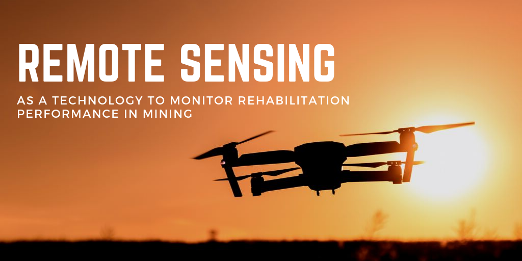
In support of the recent International Mine Closure Workshop, we thought we would explore how remote sensing can aid Mine Closure and Rehabilitation activities. Remote sensing technology has improved the capability of acquiring information about the earth and its resources for global, regional and local assessments (Wu 2019)
NASA defines remote sensing as an instrument which has two primary types – active and passive. The sensors provide their own source of energy to illuminate the objects they are observing. This is achieved by emitting radiation in the direction of the target to detects and measures the radiation that is reflected or backscattered from the target. They also can detect natural energy (radiation) that is emitted or reflected by the object being observed (NASA 2019). Over the last 20 years, there has been a significant enhancement in the area of Remote sensing that makes this tool very useful in monitoring Rehabilitation Performance.
This Insight describes some remote sensing tools and products that can be used for monitoring rehabilitation and revegetation in the resources sector.
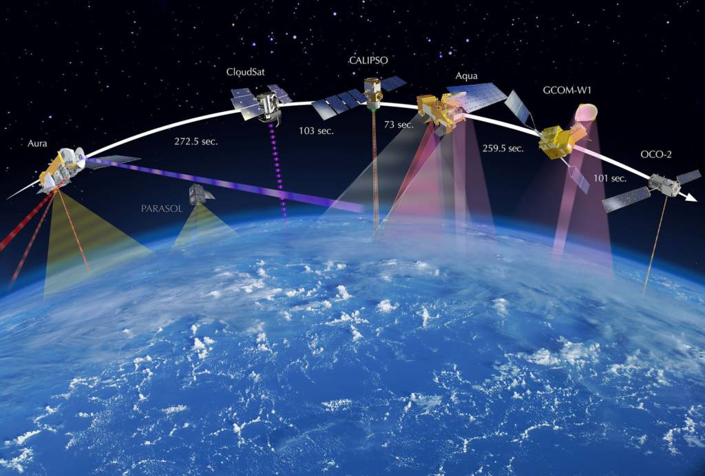
Satellites – The most famous and common tool used in remote sensing is the Satellite. The contribution of Satellites to remote sensing is through images which help to monitor areas, allowing specific phenomena to be identified, facilitating the taking complex decisions. There are several working methodologies with satellite imagery that support the mine rehabilitation, for example, Digital Elevation Models can be integrated into relief design, land use and landscape planning projects and help in surface water management and habitat restoration. Satellite imagery operates at various scales, so the data can be used to better plan mine closure.
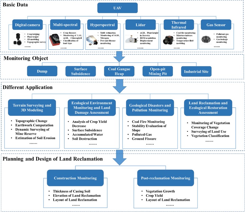
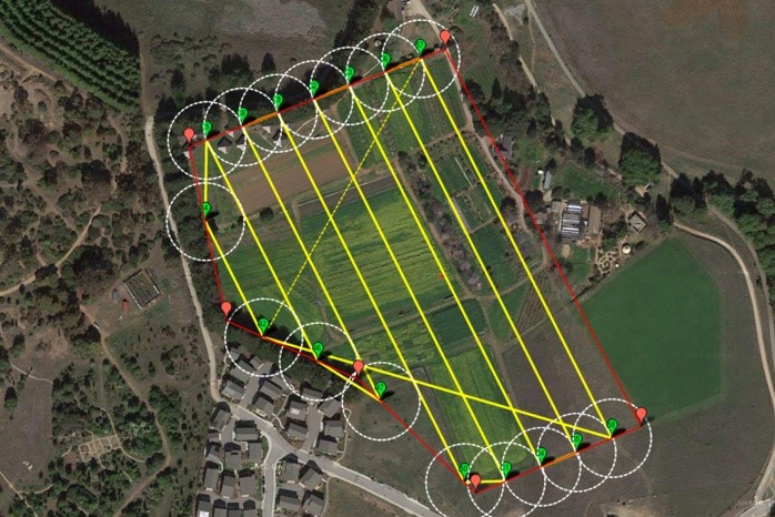
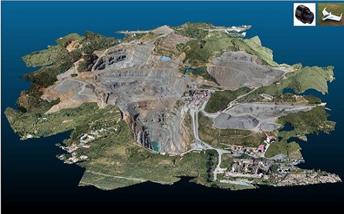
Unmanned Aerial Vehicles (UAVs) – Nowadays, Unmanned Aerial Vehicles (UAVs), popularly known as Drone, have been gaining ground as a remote sensing tool primarily in sectors such as agriculture, topography and mining. Low cost, high precision, and notable time efficiency make UAVs a reliable data acquisition method for monitoring Mining Areas. Studies have shown that the effective monitoring area of UAVs is about 100–100000 m2, and the corresponding error is about 2–20 cm (Siebert S 2014). Over the last 5 years, UAVs have shown great potential for monitoring small or large areas. UAVs equipped with different sensors can provide data for a range of monitoring activities. They can be used in terrain surveying and 3D modelling, land damage assessment and ecological monitoring, geological hazards and pollution monitoring, as well as land reclamation and ecological restoration assessment.
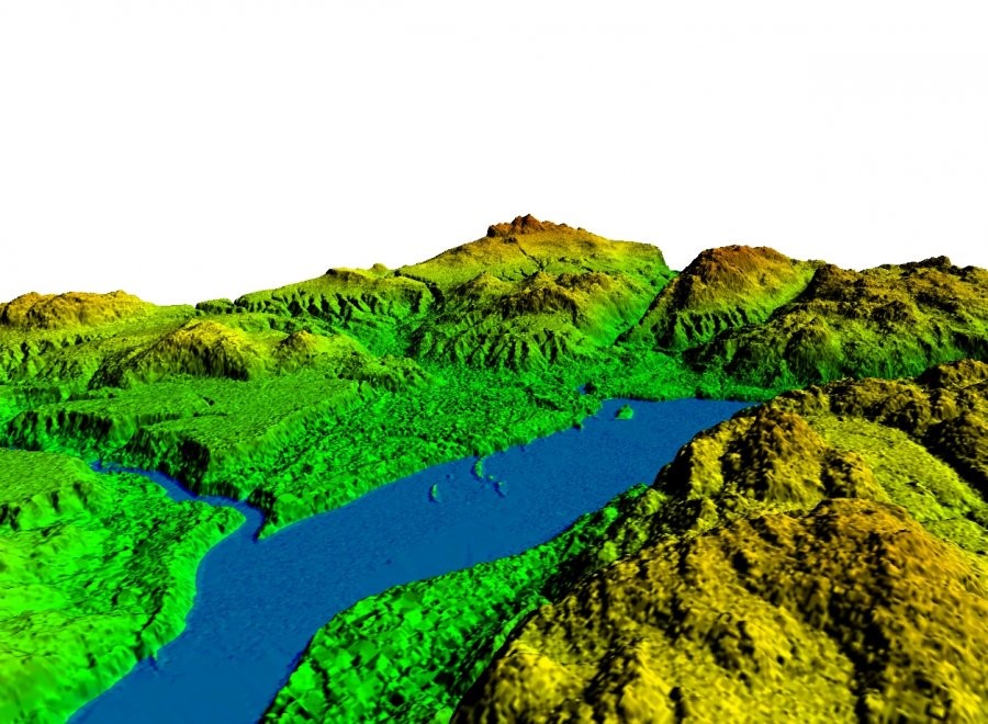
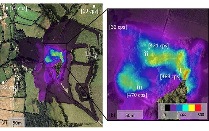
LIDAR – Remote sensing using airborne Light Detection and Ranging (LiDAR) surveys involves the process of extracting the distance from an aircraft to the earth’s surface by measuring the travel time of the emitted a laser pulse (Glennie 2013). Using this technology one can obtain highly accurate three-dimensional information about the earth’s surface and create very detailed digital models. This method is useful for monitoring slope angle changes and ground surface subsidence over time. Using LiDAR, point-clouds collected at different dates to create Digital Elevation Models (DEM) which indicate the topography. These can be used to produce elevation-difference maps which indicate the absolute vertical motion of the ground surface in the time interval between the surveys (Mcclusky S & Tregoning 2013).
Multispectral Cameras – Multi-spectral imaging is a remote sensing technique collecting more than two spectral channels to simultaneously image the ground target. Many indicators such as chlorophyll, (Hardin PJ 2011) yield and leaf area index (Tian J 2017) can be evaluated. Multi-spectral imaging also shows great potential for vegetation establishment, vegetation or crop diseases and land use identification (Johansen K 2018). It is possible to detect areas of stress vegetation, even before the onset of visual symptoms. With the diagnosis in hand, it is much simpler to send a specialist to the mapped site to take appropriate action and resolve the problem before there is significant vegetation loss.
As we have seen, there are a number of techniques for collecting remote sensing information, the remainder of this Insight show how some of these tools can be used to monitor revegetation and rehabilitation activities associated with mining.
Mine Rehabilitation
Mine Rehabilitation is the process in which previously mined areas are returned to some degree of their natural state or to a condition that can sustain an intended post-mining land-use. (Industry.gov.au. 2016).
In most cases, effective rehabilitation requires significant innovation to identify appropriate land-use opportunities not only to mitigate environmental, health and safety risks but also to stimulate economic development after mining. As we know mine rehabilitation can be challenging when trying to balance all stakeholder requirements (Limpitlaw 2005).
Risks involved with mine rehabilitation may require tools to monitor landform stability and revegetation success in the short and long-term. The continuous monitoring and analysis of revegetated areas will help determine the rate at which areas are progressing towards the desired post-mine land-use and could also highlight deficiencies that are evident (Vickers H, Gillespie M & Gravina, 2012) To monitor the success of rehabilitation practices, mining companies may use a combination of field observations and remote sensing technologies (Felinks B, Pilarski M & Wiegleb G, 1998).
Monitoring Mine Rehabilitation
During the rehabilitation process, evidence-based assessments are often required by the government. Using remote sensing tools can help to provide evidence that rehabilitation work has been completed, is of the quality required and revegetation establishment is progressing (Barker 2011).
The first step to developing an effective rehabilitation monitoring program is to understand what the rehabilitation and revegetation objectives are. The current leading practice in Australia makes extensive use of soil erosion and landform evolution models to develop landform profiles that are site and goal-specific (Howard, EJ, Loch, RJ, Vacher, CA, 2011).
Ultimately the rehabilitation outcomes are affected by local climate and rainfall erosivity, the erodibility of materials used to construct soil shape, likely vegetation cover, and resulting changes in soil function. For this reason, it is important to align landform slopes in areas to be replicated to those of natural landform in the regions. In areas with high rainfall, there is an increased possibility of erosion problems, geotechnical stability risks and poor vegetation established due to soil movement.
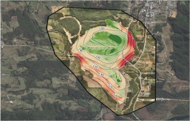
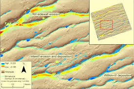
Remote sensing can be used to generated contour and digital terrain models that can identify erosion and stability issues (Esri.com 2019). From a Digital Terrain Model, level curves can be obtained and used for geoprocessing and generating slope map. Digital terrain modelling is also a useful tool for monitoring erosion. This is particularly the case in the early years were erosion gully’s and riles may form. This type of monitoring is helpful in monitoring gully and rile length, depth, and width and where corrective activities are required.
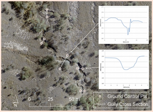
Another feature that helps in the management of erosion is the creation of time-lapse photos. This tool allows the land manager to identify unstable area, such as the areas of settlements, crack or unstable terrain and to check the raw material generated daily, by organizing the orthophotographs created by the UAV in a temporal order. It is also possible to calculate the volume of material lost due to ravine formation and area calculation. Gutter volume may represent areas of soil instability this loss of soil material will mainly affect vegetation and fauna.
Monitoring and evaluation of stability metrics can be tailored to site-specific risks and completion criteria, particularly where quantitative targets have been set.
Vegetation monitoring aims to assess how vegetation is establishing, this can be assessed by monitoring vegetation cover, vegetation health and species richness over time. Repeated image capture can assist in tracking the performance of the rehabilitation areas. Vegetation monitoring can also be used as an indicator of fauna habitat establishment. A drone flight with the embedded RGB camera combined with intelligent algorithms in the processing can estimate the number of plants per hectare. (Drones.horusaeronaves.com 2019)
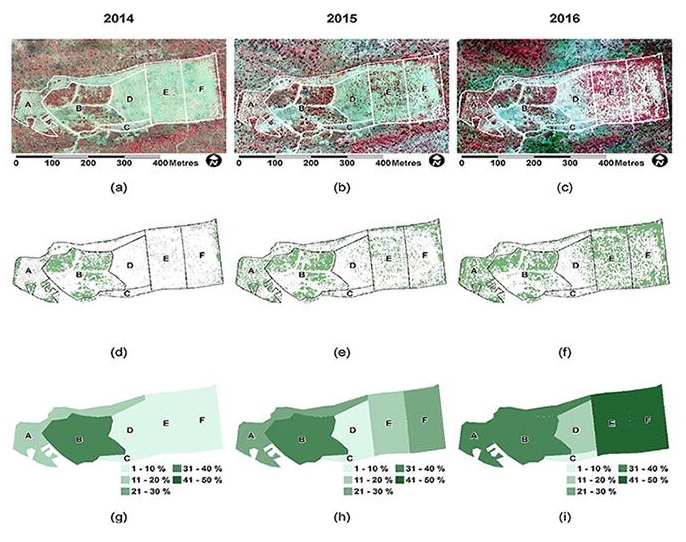
Another useful tool is the Normalized Differences Vegetation Index (NDVI) sensor. This sensor is often used to identify area of vegetation stress. This stress may be caused by acid and / or metal drainage or soils with poor physical or chemical properties. Temporal analysis and comparison with analogous vegetation can determine if rehabilitation is heading toward the desired post-mining vegetation.
If you or your company is interested in exploring what GIS can do for you or implementing a GIS tool, give Integrate Sustainability a call on 08 9468 0338 or email enquiries@integratesustainability.com.au as we can provide assistance and advice on cost-effective tools and processes.
References
Aeronaves, Horus. 2018. Horus Aeronaves. Accessed 09 05, 2019. https://horusaeronaves.com/ebook/ebook-guia-pratico-horus.pdf.
Andrew Nixon. 2019. bestdroneforthejob. 06 11. Accessed 09 05, 2019. https://bestdroneforthejob.com/drone-buying-guides/agriculture-drone-buyers-guide/.
Barker, P,. 2011. “A Technical Manual for Vegetation Monitoring.” Resource Management and Conservation, Department of Primary Industries, Water and Environment., Hobart.
Chen J, Li K, Chang K et al,. 2015. “Open-pit mining geomorphic feature characterization.” Int J Appl Earth Obs 42:76–86.
Drones.horusaeronaves.com. 2019. “Drones na Mineração: Usos e Aplicações.” Horus Aeronaves. Accessed 09 05, 2019. http://drones.horusaeronaves.com/mineracao-drones .
En.wikipedia.org. 2019. Accessed 2019.
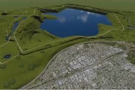
ENGIE. 2016. PHOTO: Artist’s impression of what the Hazelwood coal mine could look like filled with water to become a lake. 11 7. Accessed 09 05, 2019. https://www.abc.net.au/news/2016-11-07/hazelwood-lake/8001380.
Esri.com. 2019. What is GIS? | Geographic Information System Mapping Technology. Accessed 09 05, 2019. https://www.esri.com/en-us/what-is-gis/overview.
Felinks B, Pilarski M & Wiegleb G,. 1998. “Vegetation survey in the former brown coal mining area of eastern Germany by integrating remote sensing and ground-based methods. Applied Vegetation Science .” 1: 233–240.
Glennie, C., Carter, W., Shrestha, R. and Dietrich, W. (2013). 2013. “Geodetic imaging with airborne LiDAR: the Earth’s surface revealed. Reports on Progress in Physics.” 76(8), p.086801.
Hardin PJ, Jensen RR. 2011. “Small-scale unmanned aerial vehicles in environmental remote sensing: challenges and opportunities.” GISSCI Remote Sens 48(1):99–111.
Howard, EJ, Loch, RJ, Vacher, CA,. 2011. ” ‘Evolution of landform design concepts’.” Trans. Inst. Mining and Metallurgy 120:112–117.
Industry.gov.au. 2016. “Mine Rehabilitation.” Leading Practice Sustainable Development. Program for the Mining Industry. (2019). [online] Available at: https://www.industry.gov.au/sites/default/files/2019-04/lpsdp-mine-rehabilitation-handbook-english.pdf .
Jacobs, E. 2016. Public Data and 3D Printers Are Changing Cartography for the Awesome. 05 27. Accessed 09 05, 2019. https://www.inverse.com/article/16216-how-a-programmer-3d-printed-the-ultimate-map-of-london-using-lidar-data.
Johansen K, Erskine PD, Mccabe MF. 2018. “Using unmanned aerial vehicles to assess the rehabilitation performance of open cut coal mines.” J Clean Prod 209:819–833.
Limpitlaw. 2005. “Academia.” Accessed 09 05, 2019. https://www.academia.edu/7615680/Preparation_for_Closure_Community_Engagement_and_Readiness_Starting_with_Exploration.
Lu, X., Li, Y., Washington-Allen, R., Li, Y., Li, H. and Hu, Q,. 2017. “The effect of grid size on the quantification of erosion, deposition, and rill network.” International Soil and Water Conservation Research pp.241-251.
Martin PG, Payton OD, Fardoulis JS et al,. 2015. “The use of unmanned aerial systems for the mapping of legacy uranium mines.” J Environ Radioact 143:135–140.
Mcclusky S & Tregoning. 2013. “Background paper on subsidence monitoring and measurement.”
NASA. 2019. Earthdata.nasa.gov. (2019). . 09 05. Accessed 09 05, 2019. https://earthdata.nasa.gov/learn/remote-sensors.
Ren, H., Zhao, Y., Xiao, W. et al. Int J Coal Sci Technol,. 2019. “A review of UAV monitoring in mining areas: current status and future perspectives.” International Journal of Coal Science & Technology https://doi.org/10.1007/s40789-019-00264-5.
Siebert S, Teizer J (2014). 2014. “Mobile 3D mapping for surveying earthwork projects using an unmanned aerial vehicle (UAV) system.” 41(2):1–14.
Tian J, Wang L, Li X et al. 2017. ” Comparison of UAV and WorldView-2 imagery for mapping leaf area index of mangrove forest.” Int J Appl Earth Obs 61:22–31.
Vickers H, Gillespie M & Gravina,. 2012. “Assessing the development of rehabilitated grasslands on post-mined landforms in north west Queensland, Australia. Agriculture, Ecosystems and Environment.” 163: 72–84.
Whiteside TG, Bartolo RE,. 2018. “A robust object-based woody cover extraction technique for monitoring mine site revegetation at scale in the monsoonal tropics using multispectral RPAS imagery from different sensors. .” Int J Appl Earth Obs 73:300–312.
Wu, Y., Ma, W., Su, Q., Liu, S. and Ge, Y. (2019). 2019. “Remote sensing image registration based on local structural information and global constraint.” Journal of Applied Remote Sensing, 13(01), p.1.